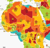
Each country is color-coded on this map by controlrisks.com — and some countries are even subdivided because certain portions are more dangerous than others. We’re not suggesting that you should evacuate today or anything. But the general guidelines might help you be sobered into taking great care with your personal daily practices in one or more of these troubling lands. See the map at…
cdn-prd-com.azureedge.net/-/media/corporate/files/riskmap/maps/riskmapmap2019uka184web.pdf
(And thanks, Justin, for finding this, then bubbling it up to us!)


Control risk does a great job producing these maps, but this map provides threat data only and is not a true risk map aas it does not consider personal or organization vulnerability. Measuring risk is an equation of threats and vulnerability which means that a high threat location, may not be high risk depending on the person traveling as well as their mission. Is a risk level different if a traveler going to Yemen in a US citizen, Saudi citizen or Yemen Citizen? Don’t be scared off by the red areas. Just look at how you can mitigate the threat level to lower your actual risk level.